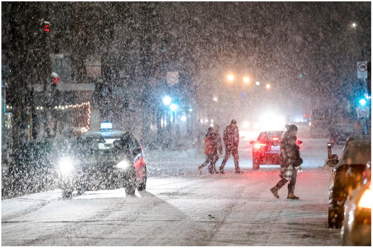
Millions of Americans will endure bitterly cold temperatures as the "life-threatening" Arctic blast continues into Christmas Day.
The National Weather Service (NWS) said on Sunday that Storm Elliot will continue to roll frigid temperatures down into the central and eastern U.S. today.
Icy winds have sent temperatures plummeting to as low as minus 18 degrees and minus 12 degrees Fahrenheit in Minnesota and North Dakota respectively, according to Weather Central.
NWS officials have issued multiple weather warnings across the U.S. with states bordering the Great Lakes being told to expect temperatures to fall to as low as minus 25 degrees Fahrenheit.
"With the persistent Arctic blast under the tight pressure gradient on the back side of the low-pressure system over the open warm waters of the Great Lakes, lake-effect snows with local blizzard conditions may linger into Christmas Day," the NWS said.
Harrowing videos showed the powerful storm ushering in whiteout conditions in Buffalo, New York. The extreme weather led New York Governor Kathy Hochul to declare a state of emergency on Thursday.
Between two and four feet of snow is expected to be reached in "the favored snow belts," although conditions are expected to slowly improve in the coming days.
Further snowfall is expected in the next couple of days across the Northern Plains and Midwest while freezing rain is set to shower parts of the Northern High Plains today.
The once-in-a-generation storm has resulted in serious travel disruptions across the country with thousands of flights being canceled or delayed in the run-up to the holiday weekend.
But the NWS has warned that traveling in today's conditions "will be extremely dangerous" in the most intense snow bands.
It added: "The cold temperatures and in combination with dangerous wind chills will create a potentially life-threatening hazard for travelers that become stranded, individuals that work outside, livestock and domestic pets.
"If you must travel or be out in the elements, prepare for extreme cold by dressing in layers, covering as much exposed areas of skin as possible, and pack winter safety kits in your vehicles.
"In some areas, being outdoors could lead to frostbite in minutes. Ensure outdoor animals and livestock have sufficient shelter."
At least 17 people have been killed and hundreds of thousands of homes have been left without power since the storm erupted before Christmas.
Meanwhile, temperatures in western states are set to stay milder than the seasonal average, although a low-pressure system coming in from the Pacific will lead to increased rainfall along the Pacific Northwest.
The NWS said the rainfall could lead to excess runoff and officials are continuing to monitor a potential threat for local flash flooding.
Newsweek has contacted the NWS for comment.
Uncommon Knowledge
Newsweek is committed to challenging conventional wisdom and finding connections in the search for common ground.
Newsweek is committed to challenging conventional wisdom and finding connections in the search for common ground.
About the writer
Anders Anglesey is a U.S. News Reporter based in London, U.K., covering crime, politics, online extremism and trending stories. Anders ... Read more
To read how Newsweek uses AI as a newsroom tool, Click here.