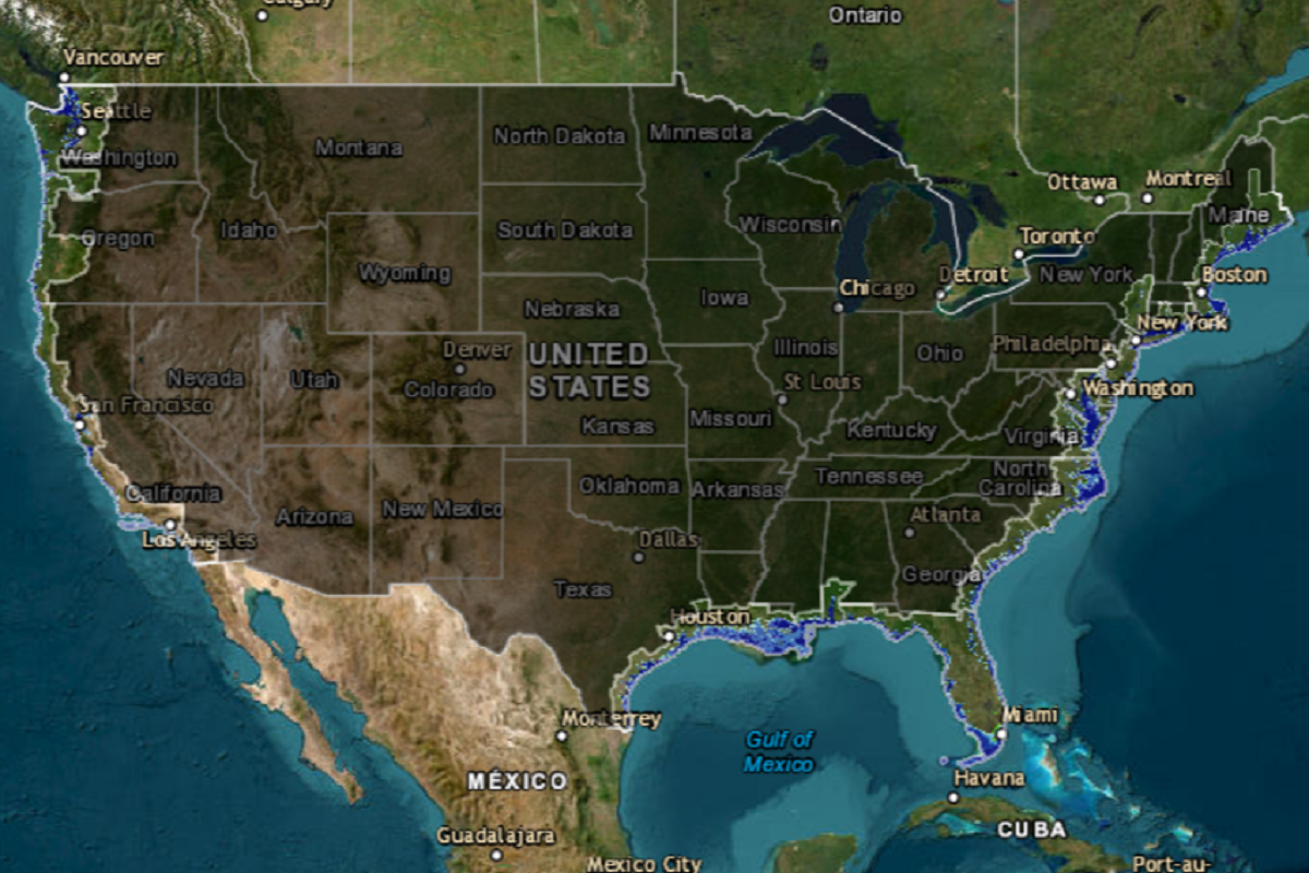
A map of the contiguous U.S. shows how coastal states would be affected by 6 feet of sea level rise, an environmental change that could occur by the end of the next century due to ice sheet loss accelerated by climate change.
The Intergovernmental Panel on Climate Change (IPCC) estimates there will be between 43 and 84 centimeters (1.4 and 2.8 feet) of sea level rise by the year 2100, but said that an increase of 2 meters (6.6 feet) "cannot be ruled out."
Sea levels are expected to rise because of sheet ice melting, particularly near the poles. Antarctica contains enough frozen water to raise sea levels by 190 feet, while Greenland's ice sheet holds enough to raise them by a further 23 feet. If all the world's ice melted, the sea would rise by 216 feet.
Climate scientists say that a complete loss of ice sheets would take potentially thousands of years to occur. But the more global average temperatures increase, the more likely this is to occur, they say.
However, global ice sheet loss over time is difficult to predict, as different ice sheets have differing levels of vulnerability to melting. Some could experience a sudden collapse that would rapidly place a large amount of water in the oceans.
David Thornalley, a professor of ocean and climate science at University College London, previously told Newsweek that the most vulnerable ice sheets are those in the Antarctic that are marine-based. That is, the bottom of the ice sheet sits on land that is below sea level, making such sheets "susceptible to runaway processes that can cause very rapid collapse of the ice sheet over centuries."
But there is "still large uncertainty on just how fast the ice sheets may melt, so it is a topic of real concern," he said.
Which parts of the U.S.—or any landmass—would be subsumed by water depends not only on the amount sea levels rise but also on the terrain at the elevation the sea rises to, which will affect how wide an area would become underwater.
For instance, New York would see fairly marginal changes to its coastline with 6 feet of sea level rise, but if all the ice sheets melted, it is expected that most of New York City and all of Long Island would be subsumed by the Atlantic.
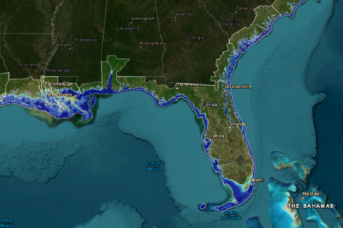
According to projections by the National Oceanic and Atmospheric Administration, assuming the IPCC's worst-case scenario comes true, the Carolinas, Florida and Louisiana would likely be the worst affected states.

North Carolina would lose at least three coastal counties, with others greatly reduced in size. Whole neighborhoods of Charleston, South Carolina, would become submerged, creating new islands in places.
In Florida, Much of the Keys would disappear, all of Monroe County would be gone, and the coastlines around Cape Coral, St. Petersburg and Tampa would retreat significantly. A large swath of Miami-Dade County would become submerged, with neighborhoods of Miami reclaimed by the ocean.
Much of Louisiana's low-lying coastline would recede, and New Orleans would be connected to the mainland only via a thin strip of land running along the Mississippi River. The area from Larose to Golden Meadow would become a new island in the Gulf of Mexico.

Coastal regions of eastern Texas would also be vulnerable, including around Galveston.
Overall, the Atlantic coast is predicted to fare far worse than the Pacific because of the more mountainous terrain in the West, although all coastal areas would recede.
A 2013 analysis by National Geographic suggested that if all the world's ice sheets melted, the entirety of Florida would disappear underwater, as well as most of Louisiana and large portions of the Carolinas and Virginia.
The East Coast's Delmarva Peninsula would be subsumed by the ocean, as would a large portion of southern New Jersey.
In the West, San Francisco's hills would become islands, while California's Central Valley would become a new, large inland bay. Seattle would be greatly reduced, while the Gulf of California would extend north of San Diego.
Uncommon Knowledge
Newsweek is committed to challenging conventional wisdom and finding connections in the search for common ground.
Newsweek is committed to challenging conventional wisdom and finding connections in the search for common ground.
About the writer
Aleks Phillips is a Newsweek U.S. News Reporter based in London. His focus is on U.S. politics and the environment. ... Read more