A map by the National Oceanic and Atmospheric Administration reveals the areas of the U.S. that are most at risk from flooding and tsunamis as the sea level continues to rise.
As climate change increases air and ocean temperatures worldwide, the oceans are creeping ever higher, because of the melting of polar ice caps and glaciers.
The sea level along the U.S. coasts is expected to rise between 10 and 12 inches on average over the next 30 years, with a worst-case scenario of 7 feet by 2100 if emissions continue to remain high. As sea levels rise, the frequency and severity of coastal flooding increases, especially during storm surges associated with hurricanes and other severe weather events, leading to more extensive flooding.
"Sea level rise will create a profound shift in coastal flooding over the next 30 years by causing tide and storm surge heights to increase and reach further inland. By 2050, 'moderate' (typically damaging) flooding is expected to occur, on average, more than 10 times as often as it does today, and can be intensified by local factors," NOAA said in their 2022 Sea Level Rise Technical Report.
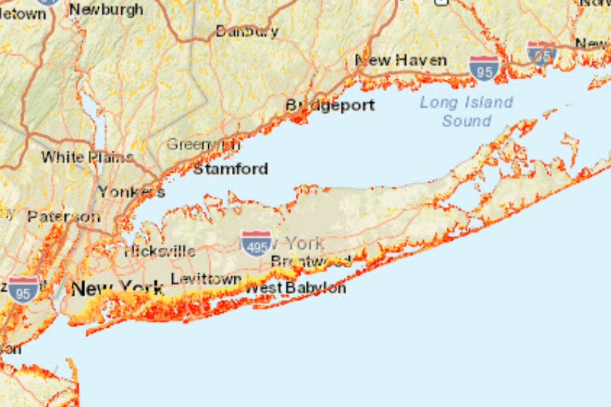
The NOAA map reveals the areas of the U.S. that are at risk of flooding from a variety of hazards, ranging from storm surges and tsunamis to high tide flooding and sea level rise.
Red areas of the map are those with more of those flood hazard zones present, while yellower areas have fewer hazard zones.
"The Coastal Flood Hazard Composite layer was created from combining flood zones from several flood hazard datasets (sea level rise, FEMA flood zones, tsunami, hurricane storm surge, etc.)," David Betenbaugh, a senior geospatial analyst at NOAA's Office for Coastal, told Newsweek. "The darker the color, the more flood zones there are for that area."
"Several variables contribute to flood risks, including location, elevation, shoreline shape, nearshore characteristics, to name a few," he said.
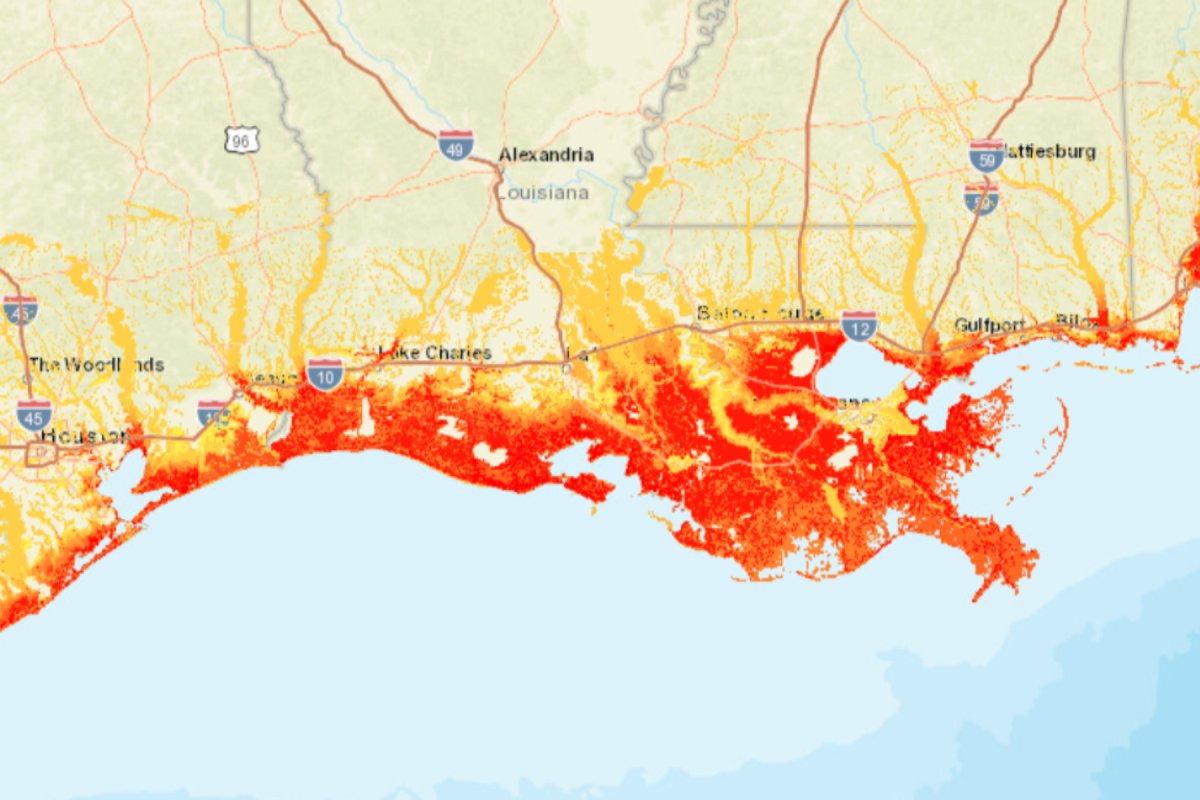
Texas and Louisiana
The coastline of eastern Texas and Louisiana appears to be particularly at risk, with large areas of red and yellow regions stretching far inland. Between Houston and New Orleans, the map shows that the coast is largely at risk of high tide flooding, sea level rise of up to 3 feet, and storm surges from hurricanes.
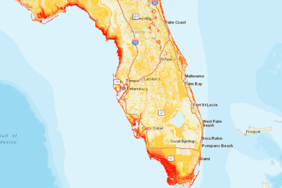
Florida
The West, South, and Northeastern coasts of Florida are also shown to have large areas of red, with yellow areas stretching inland. The southernmost tip of Florida and the Keys are especially drenched in red, with numerous flood hazards present, including a sea level rise of up to 3 feet and hurricane storm surges.
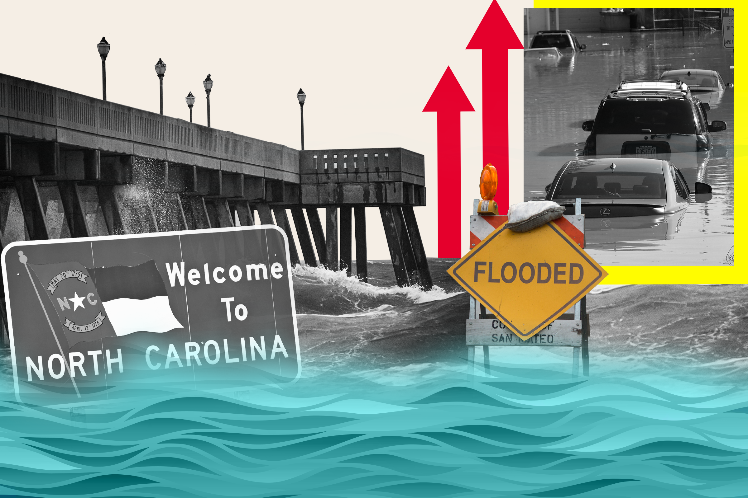
North and South Carolina
The Carolinas are also at risk, with large wide patches of their coastlines covered in red, especially surrounding Charlestown, and near Albemarle and Pamlico Sound.


New York
Large stretches of Long Island have vast areas of red and yellow, especially the southern coast.
California
Los Angeles can be seen to have large areas of yellow and orange inland, with red areas on the coastline, while the Bay Area is coated in vast amounts of dark orange, with a huge chunk of yellow stretching up to Sacramento.


"The flood hazard layers we display in the Coastal Flood Exposure Mapper, represent modeled conditions. They represent scenarios for both current and future risk," Betenbaugh said.
Rising sea levels and flooding pose a direct threat to these regions, potentially displacing large populations, damaging property, and straining resources and social services. The economic impacts of rising sea levels can be vast, including damage to infrastructure, increased insurance costs, and lost revenue from degraded natural resources. Coastal tourism, an economic lifeline for many communities, can be particularly hard hit.
Increased sea levels can also submerge wetlands and other low-lying lands, leading to the loss of important ecosystems. These ecosystems often play crucial roles in supporting diverse wildlife, including migratory birds, fish, and other marine organisms.
Do you have a tip on a science story that Newsweek should be covering? Do you have a question about flooding and sea level rise? Let us know via science@newsweek.com.
Uncommon Knowledge
Newsweek is committed to challenging conventional wisdom and finding connections in the search for common ground.
Newsweek is committed to challenging conventional wisdom and finding connections in the search for common ground.
About the writer
Jess Thomson is a Newsweek Science Reporter based in London UK. Her focus is reporting on science, technology and healthcare. ... Read more
To read how Newsweek uses AI as a newsroom tool, Click here.